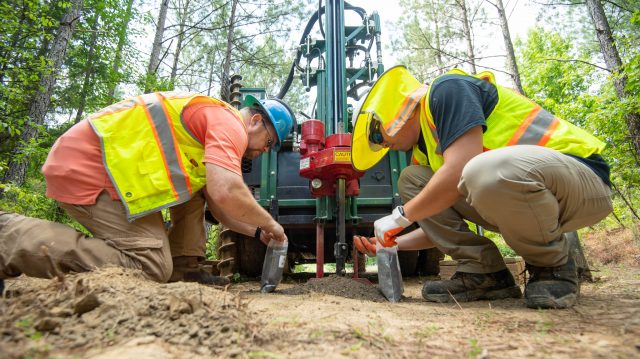
UM graduate student Kristian Macis (right) and Lance Yarbrough, associate professor of geology and geological engineering, collect auger cuttings from the Porters Creek Formation in Tippah County for laboratory analysis. Photo by Kevin Bain/Ole Miss Digital Imaging Services
OXFORD, Miss. – A joint research drilling project between the Mississippi Mineral Resources Institute at the University of Mississippi and a northeast Mississippi mining company is producing benefits for both partners.
MMRI and Profile Products in Blue Mountain are in the middle of the ongoing project, which began in May. Profile Products mines the clays of the Porters Creek Formation in Tippah County and produces products used to construct and maintain athletics fields across the country.
Researchers and students at MMRI and the UM Department of Geology and Geological Engineering are drilling a series of test holes on property leased by the company.
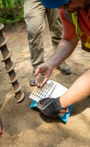
Lance Yarbrough, UM associate professor of geology and geological engineering, uses a Munsell chart to record the correct color of clays observed in the field. Photo by Kevin Bain/Ole Miss Digital Imaging Services
“The project is an ideal opportunity for both Profile Products and the University of Mississippi to collect important research data,” said Greg Easson, MMRI director and professor of geology and geological engineering.
“The UM research team was provided access to an ideal site to conduct a drilling campaign that can be used to validate geophysical methods for subsurface characterization. In addition, the team gets samples of the clay for a geological analysis of its character and origin.
“Meanwhile, Profile Products acquires the data they need to determine the amount of clay reserves on the property and samples for testing in their in-house lab to maintain consistency in the products they produce.”
The team is using a drill rig purchased with funds provided by the Mississippi Legislature through a grant program from the Mississippi Board of Licensure for Professional Engineers and Surveyors. During the drilling process, data are collected from the layers of clay being mined and continue through the different types of soil underneath the earth’s surface.
Subsurface samples collected are divided in the field, with half of them provided to Profile Products for testing in its lab to see if the material meets its specifications.
The other half of the samples for each depth will be retained and analyzed by the UM research team to help understand the geological history and origin of this geological formation. Findings will form the core of an Ole Miss graduate student’s thesis.
As part of the research team is drilling, other researchers and students are collecting geophysical data along the same path. The methods for collecting geophysical data include ground-penetrating radar, electrical resistivity and passive seismic (the detection of natural, low-frequency earth movements).
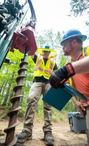
Geological engineering professor Lance Yarbrough (right) and second-year graduate student Kristian Macis auger a borehole in Tippah County. Photo by Kevin Bain/Ole Miss Digital Imaging Services
Data collected using these methods will be compared to the drilling data to determine the accuracy of the geophysical methods.
“Profile Products has agreed to provide the UM team access to the site so that we can process the data, reconfigure the systems and collect another set of data,” Easson said. “This research will provide the UM research team with validation of the level of accuracy of the geophysical data to show how these methods can be used in areas where drilling is not allowed, such as levees on the Mississippi River.”
The partnership between the company and MMRI is mutually beneficial, said Chas Goff, plant manager at Profile Products.
“The reserve data will allow Profile Products to expand our operations,” Goff said. “The students are learning how to drill safely and how to sample and work with clients.”
The drilling and reserve estimate for the project will be completed by the end of July, with analysis and additional geophysical data collection continuing into September.