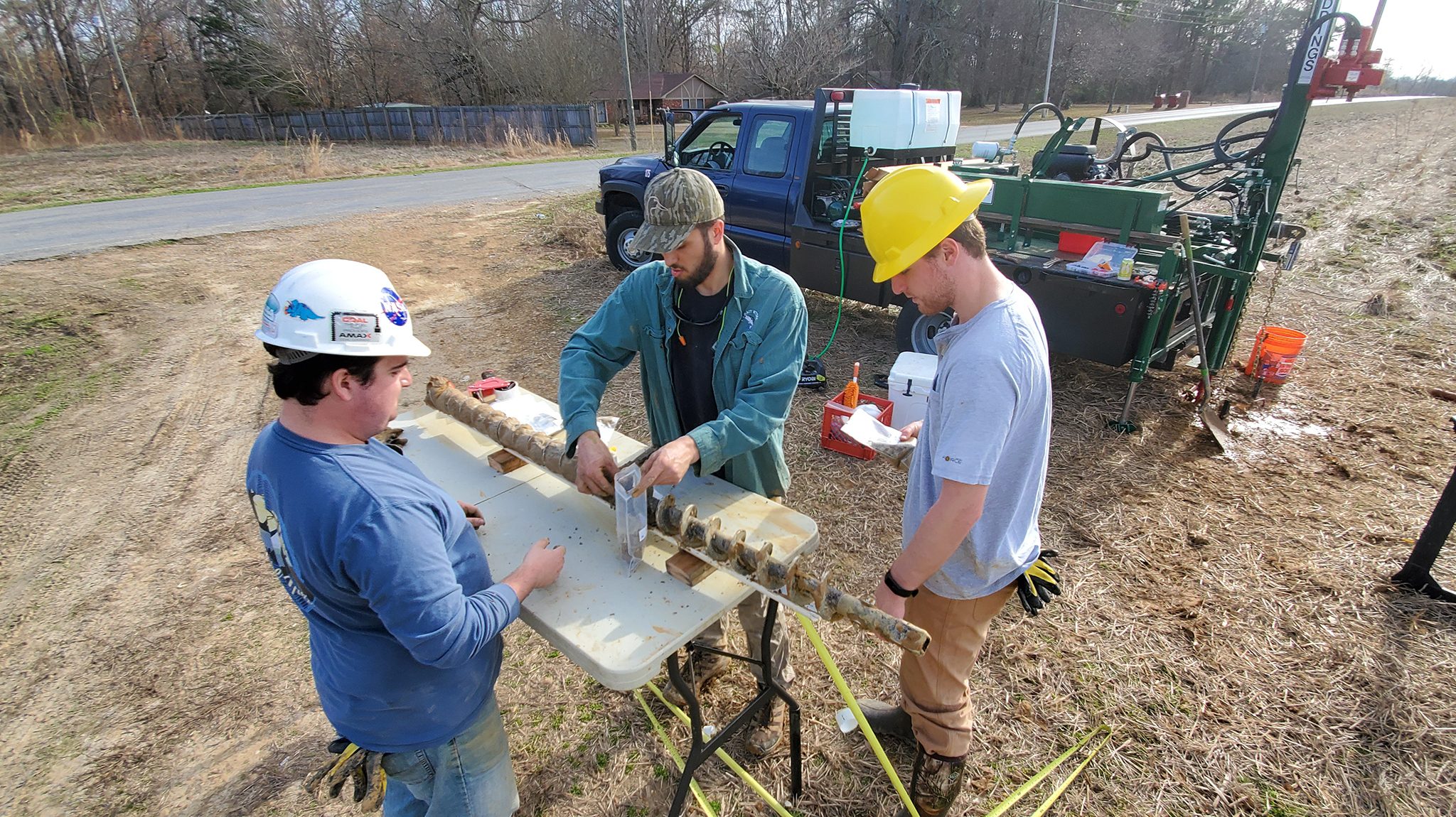
Graduate student Brad Lewis (left) supervises two students while working on the USGS-M Partner drilling project in Charleston. Submitted photo
Students and faculty from the Mississippi Mineral Resources Institute and Department of Geology and Geological Engineering at the University of Mississippi are working on a research project in Charleston, Mississippi, that involves drilling and geologic mapping, and may yield a source of economic development for the community.
The U.S. Geological Survey is funding the educational mapping project, or EDMAP, which is designed to teach students geologic-mapping techniques through rigorous field mapping.
Ron Counts, MMRI associate director and research assistant professor, said he chose the Charleston 7.5 minute quadrangle for scientific, logistic and socioeconomic reasons.
“Scientifically, the quadrangle includes the transition from the upland hill country to the Delta, and mapping this area has the potential to contribute to multiple scientific endeavors, including improving our understanding of how the Mississippi Embayment has evolved over time,” Counts said.
“Logistically, the quadrangle is only about 50 miles from Oxford and is easy to get to, allowing us to maximize our time in the field. The socioeconomic reasons were that the hills of the map area contain gravel deposits, which are an economic resource, and the unconfined aquifer in the Delta is the second-most valuable aquifer in the country in terms of agriculture and industry and is the subject of active research by the USGS.”
Quadrangle-scale geologic mapping compiles all existing geologic data and uses fieldwork and drilling to verify the accuracy of the existing data and to provide new data to areas that lack information.
The drilling equipment for the project was purchased with a grant from the Mississippi Board of Licensure for Professional Engineers and Surveyors and supplemented by funding from MMRI, the Department of Geology and Geological Engineering, the National Center for Physical Acoustics and the School of Engineering.
MMRI researchers intend to drill around 20 sites in the Charleston quadrangle and started drilling during winter intersession. Drilling is about 25 percent complete.
“I am teaching the students how to operate the drill, and we have an open invitation for GGE undergrad and grad students to accompany us in the field,” Counts said. “So far, the drilling has included GGE grad students Bradley Lewis and Steven Terracina, and GGE undergrad Mike Gugino.”
Using a new drill, the drillers are implementing and testing some modifications to improve core recovery. The cores are ranging from 8 to 10 meters in depth, and Counts said the team expected to drill for another 10 to 12 days.
“When the project is finished, we will have a completed, 1:24,000 scale geologic map of the Charleston quadrangle,” he said.
The value of geologic mapping is difficult to quantify; yet, every year, state geologic surveyors must justify their mapping efforts and compete for the limited state and federal funding available to support mapping.
In an effort to quantify the value of geologic mapping, economists at the University of Illinois conducted a comprehensive cost benefit analysis and concluded that the average cost of creating a geologic quadrangle map for a state geologic survey was equivalent to $127,000, but over a 20-year period, the average economic benefit of geologic maps was at least 25 to 38 times the original cost of making the map.
“So, published research suggests the aggregate value of geologic mapping to the community around Charleston could potentially be $3.1 (million) to $4.8 million over the next 20 years,” Counts said.
The drilling would help identify potential locations to open new gravel pits that could be used for economic development in the area. Charleston is one of the three communities involved with M Partner, a UM initiative that seeks to match university capabilities with the goals and needs of local communities.
“Dr. Counts and graduate student Bradley Lewis are making a direct contribution to the work of M Partner in Charleston,” said Laura Martin, M Partner director and associate director of the McLean Institute for Public Service and Community Engagement.
“In the planning phase of M Partner, community members shared their vision for a thriving economy in Charleston. This project has the potential to identify economic resources that can lead to new business ventures and contribute to scientific research in the region.”